Avalon Peninsula mapped by S.B.Misra in 1967*

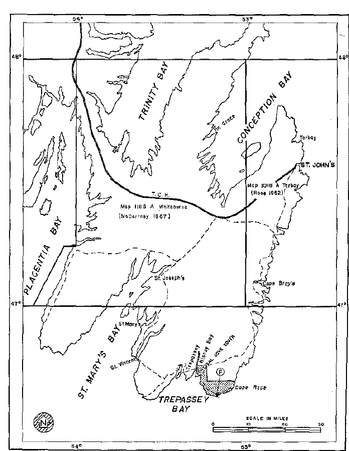
Figure 1. Map of the Avalon Peninsula of Newfoundland showing the fossil locality (F). *Dotted part of the peninsula was mapped by S.B.Misra during the summer of 1967. (GSA Bulletin 1969, v.80, p.2133-2140 )

Map of the Avalon Peninsula of Newfoundland showing the fossil locality Dotted part of the peninsula was mapped by S.B.Misra during the summer of 1967.

Please close this window to go back